Project Descriptions
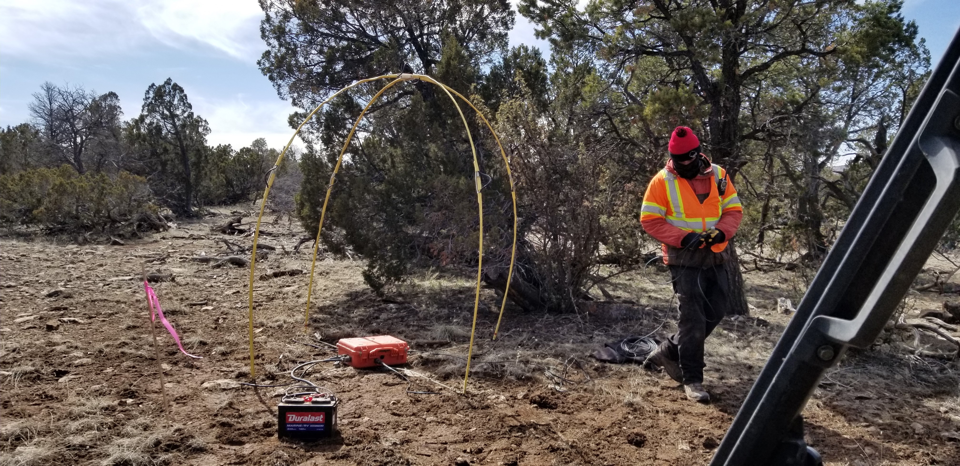
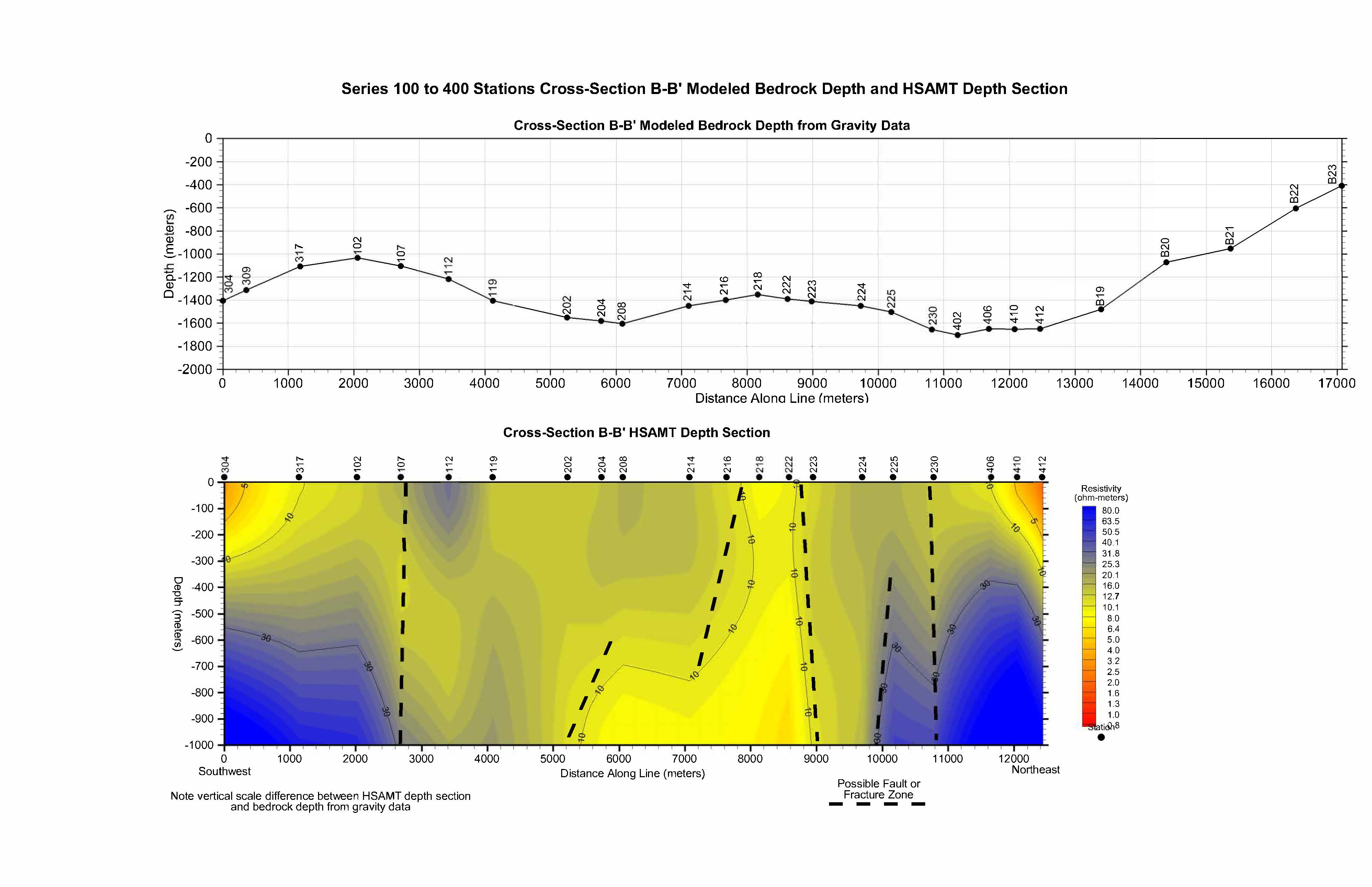
HSAMT for Well Siting, Arizona
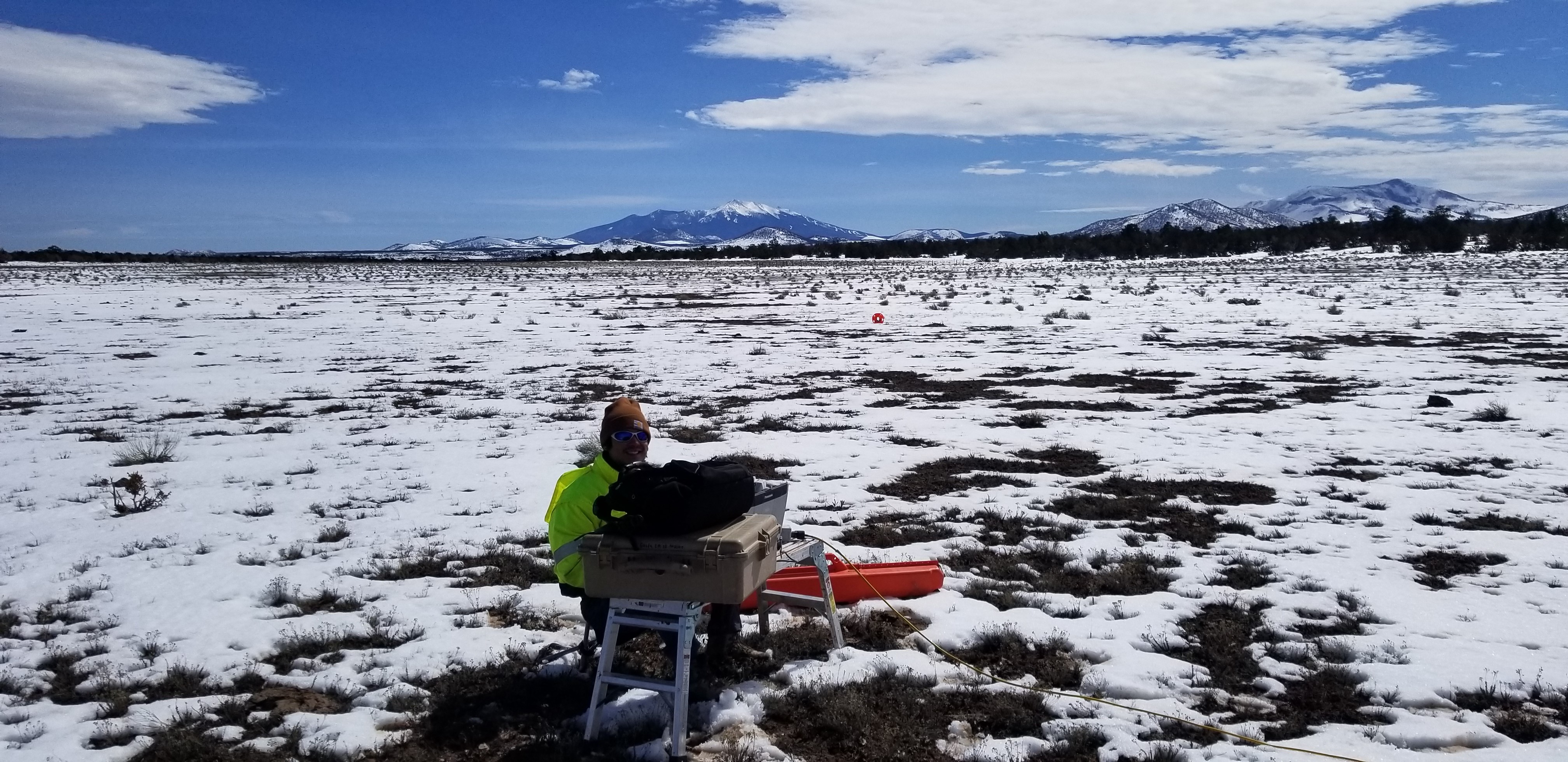
Advantage Geophysics, Inc. was contracted to perform a Hybrid Source Audio Magnetotellurics (HSAMT) evaluation as part of a well siting evaluation in northern Arizona. Despite the challenging snow covered and saturated fat-clay terrain of the 16 square mile evaluation area, Advantage Geophysics, Inc. was able to collect high quality resistivity data down to 3,500 feet below ground surface over the course of 20 days. The HSAMT models generated were used to interpret and recommend prioritized locations for a productive groundwater well based on the presence of a fracture-controlled bedrock aquifer and our detections of bedrock fracture locations having anomalously low resistivity values. Data was collected at nearly 100 HSAMT stations using a 500-foot station spacing over 11 transects in a remote area.
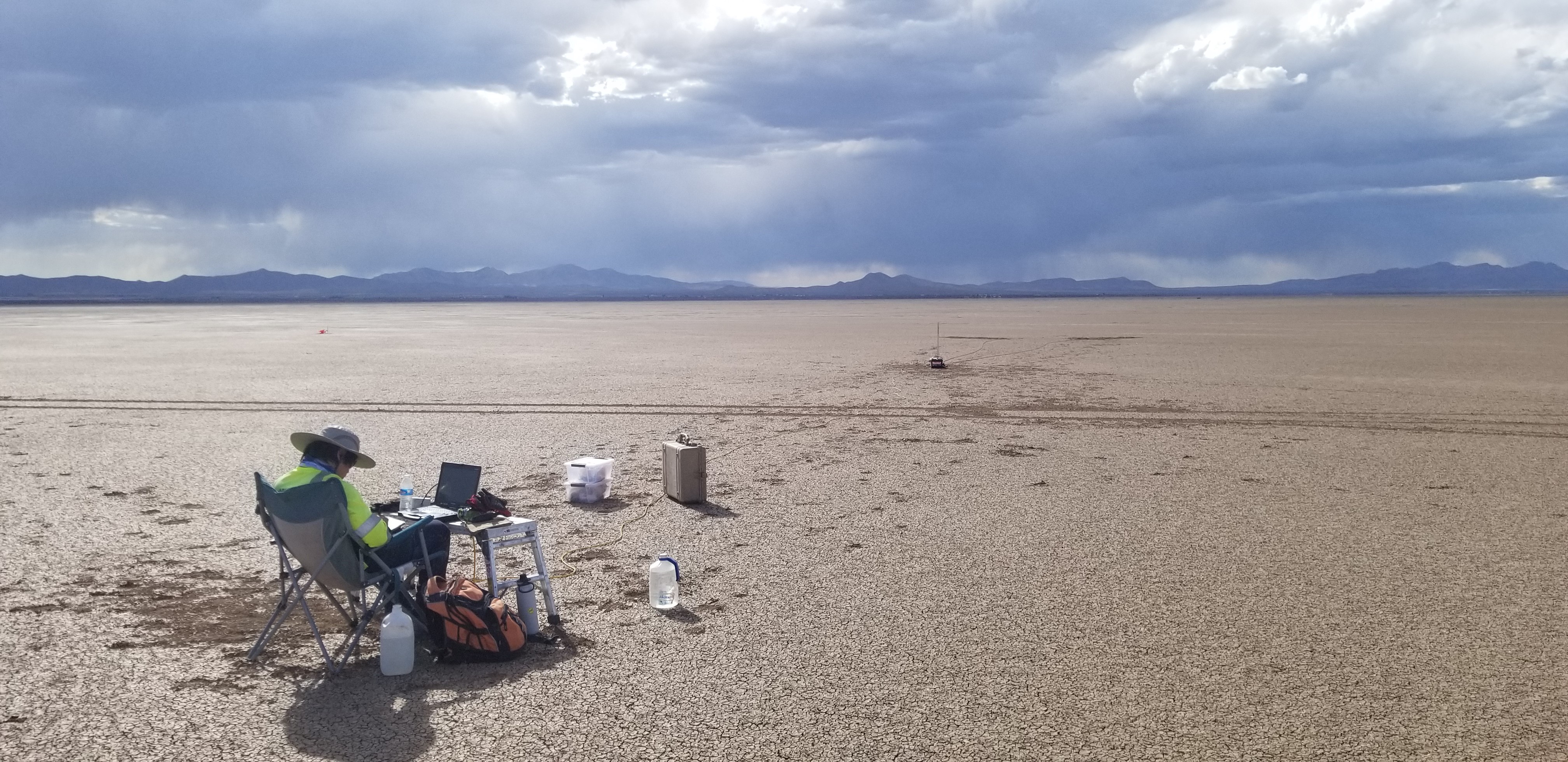
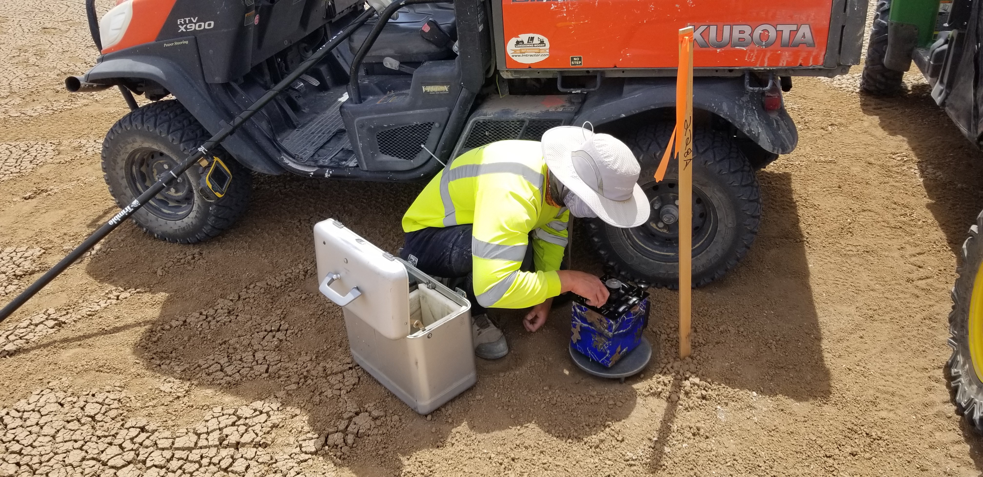
Lithium Brine Exploration, Arizona
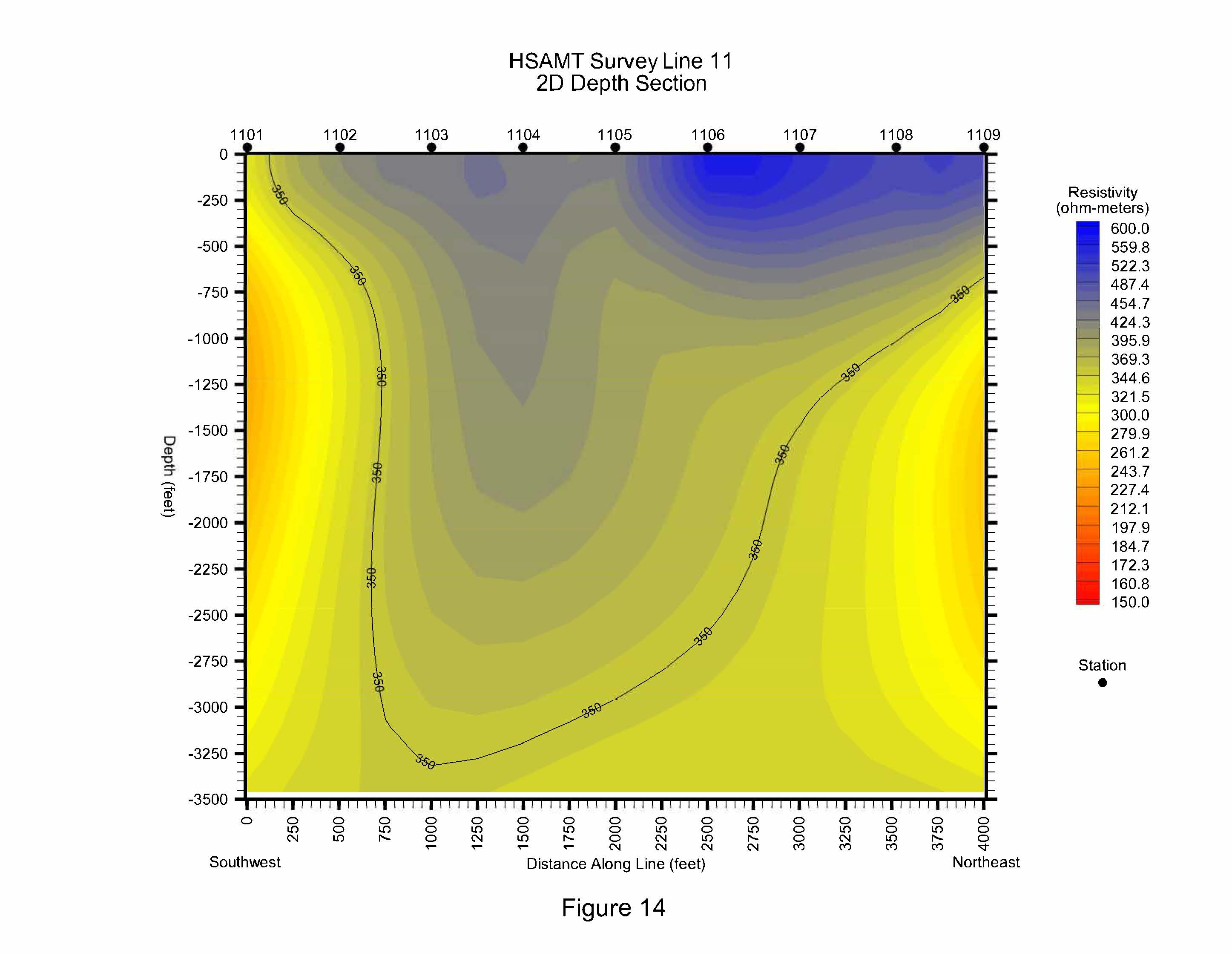
Advantage Geophysics, Inc. was contracted to perform a Gravity and HSAMT evaluation as part of a Lithium Brine exploration project in southeastern Arizona. Over the course of 19 days of HSAMT data collection and 12 days of gravity data collection, we were able to model the geologic structure and electrical resistivity within the basin. After comparing the data quality using stainless-steel electrodes vs porous pots at this site, it was determined that using porous pots for the receivers provided the highest quality data at the depth of interest.
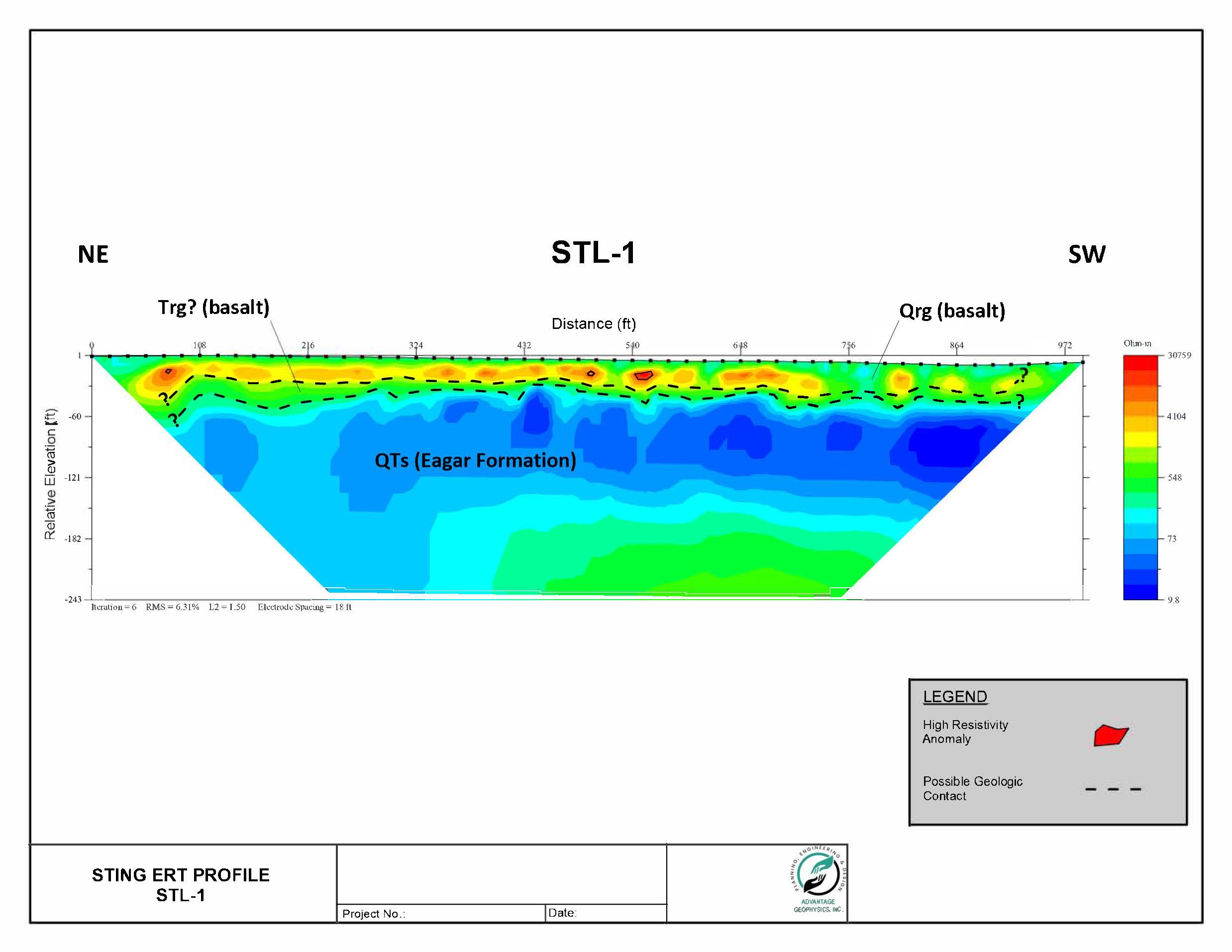
Void Detection in Bedrock, Arizona
Advantage Geophysics, Inc. was contracted to perform a limited Electrical Resistivity Tomography (ERT) evaluation in search of a void in the Basalt bedrock subsurface. Due to limited time to cover a large area and the necessity of drilling the basalt bedrock to emplace electrodes, an 18-foot electrode spacing was used. The 2-D resistivity profile revealed a small high resistivity anomaly consistent with a relatively shallow void. On a future project like this with more time given, the MASW method could also be used to further scan the area for shallow voids.
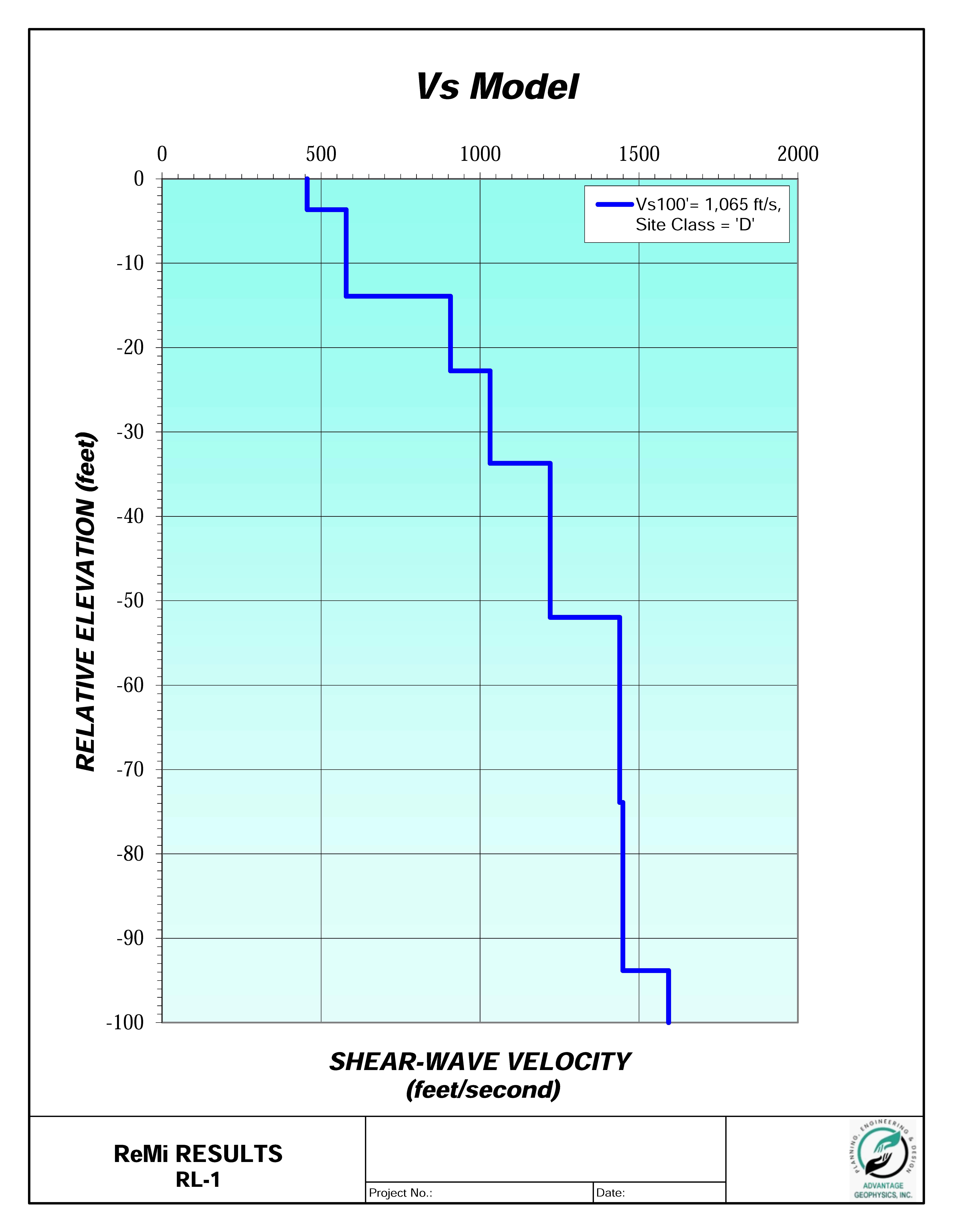
Seismic and Electrical Resistivity Investigation, Arizona
Advantage Geophysics, Inc. was contracted to perform a geophysical evaluation involving surface to downhole seismic testing, seismic refraction tomography, Wenner array electrical resistivity testing, and Refraction Microtremor (ReMi). The Wenner array electrical resistivity testing was performed in general accordance with ASTM G57 and IEEE Std. 81 at “a” spacings between 1 and 400 feet. Surface to downhole seismic testing was performed in general accordance with ASTM D7400 at 5 feet intervals below ground surface in two separate PVC cased boreholes to obtain the average P-wave velocity, shear wave velocity, and Poisson's Ratio in each depth interval. ReMi was performed to determine IBC Vs30 for seismic Site Class. The collected electrical resistivity data and surface to downhole seismic data were provided in an illustrated report along with our P-wave and S-wave velocity models and table of calculated Poisson's Ratios.
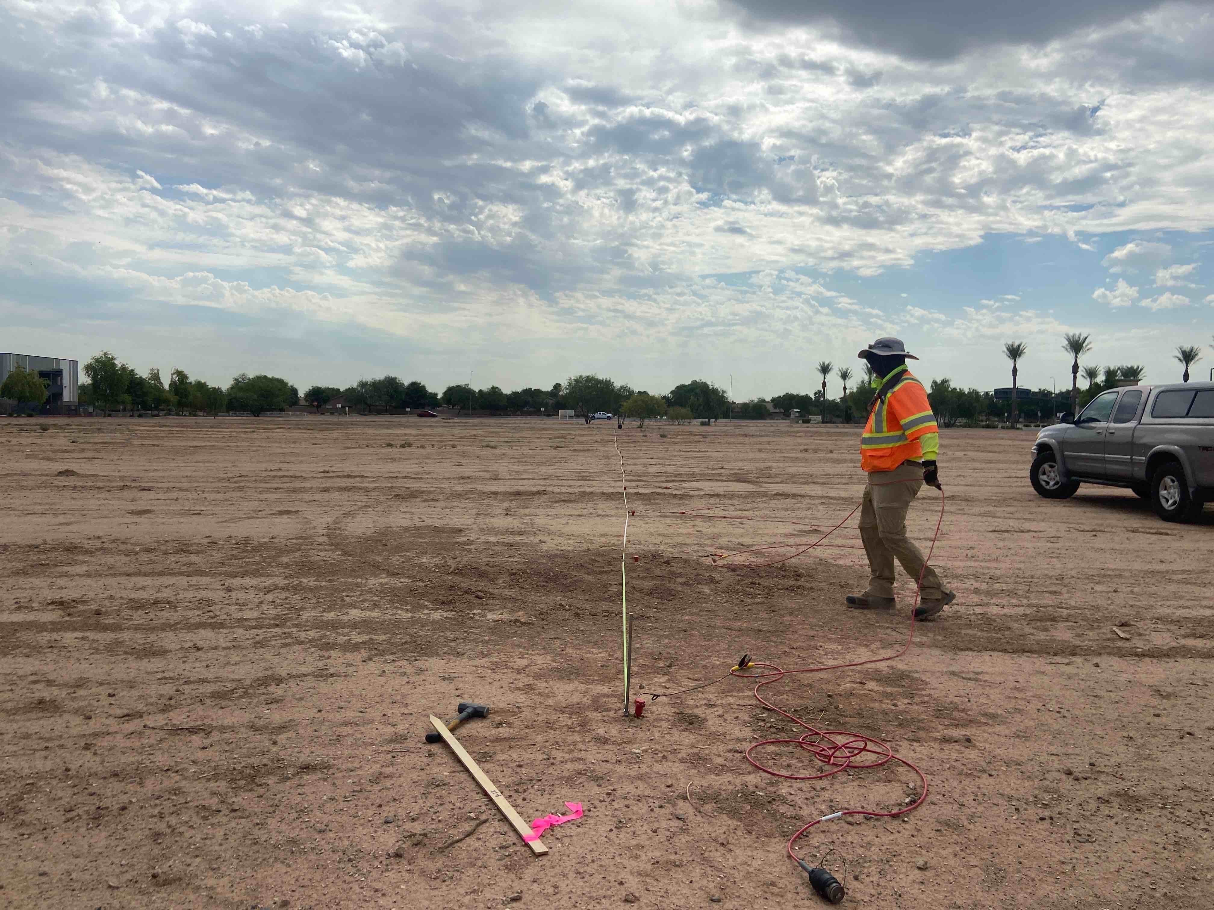
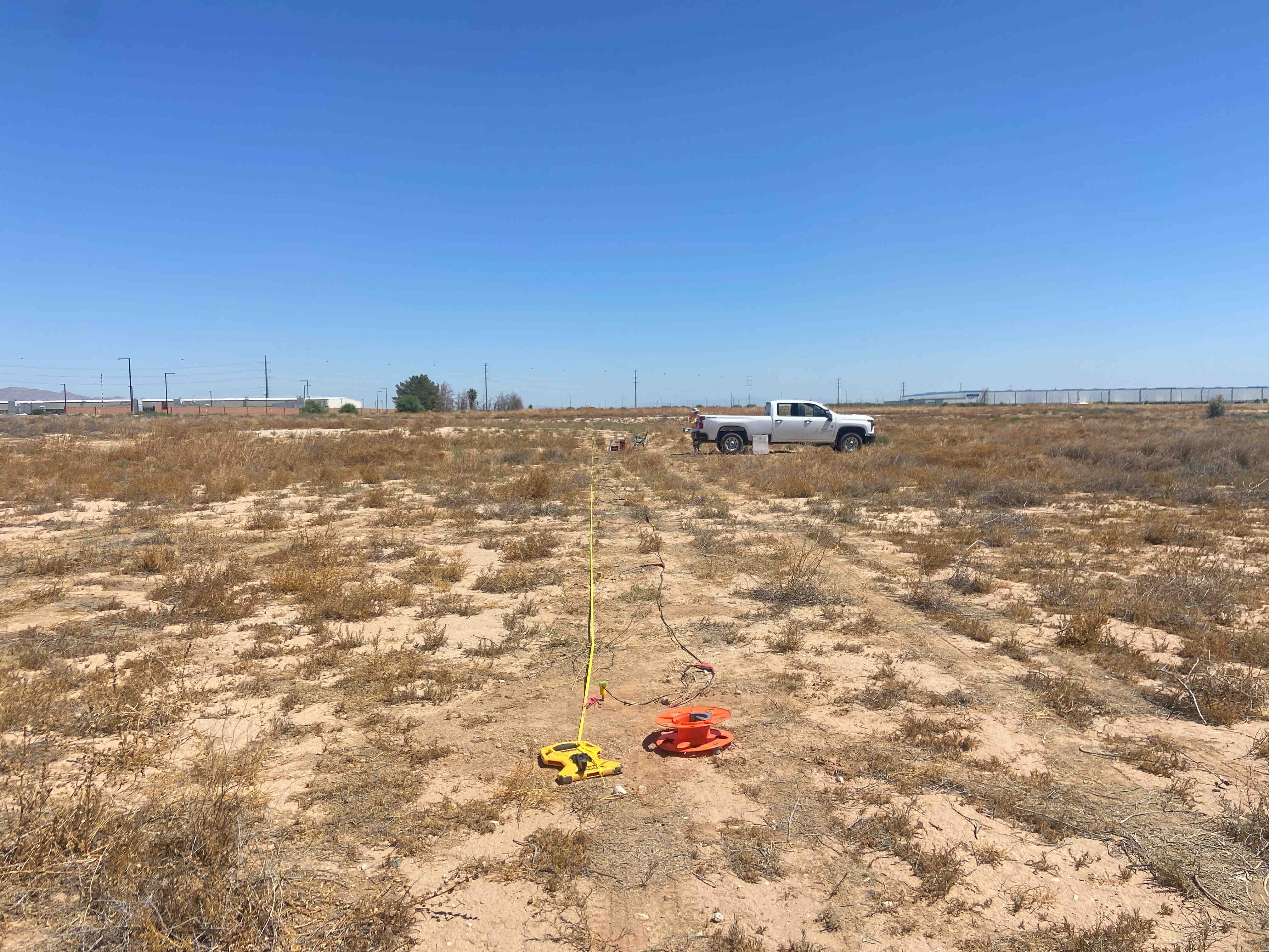
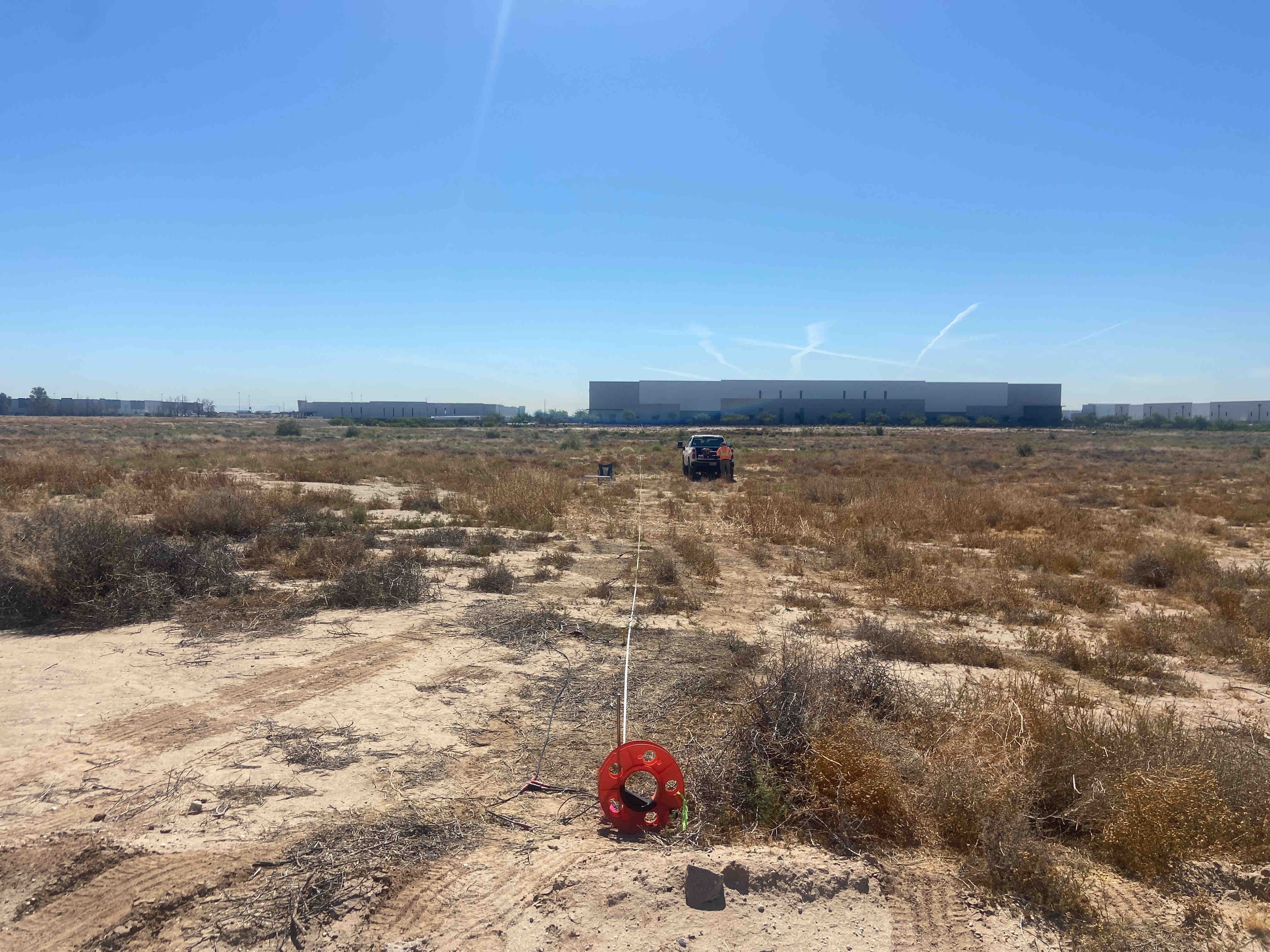
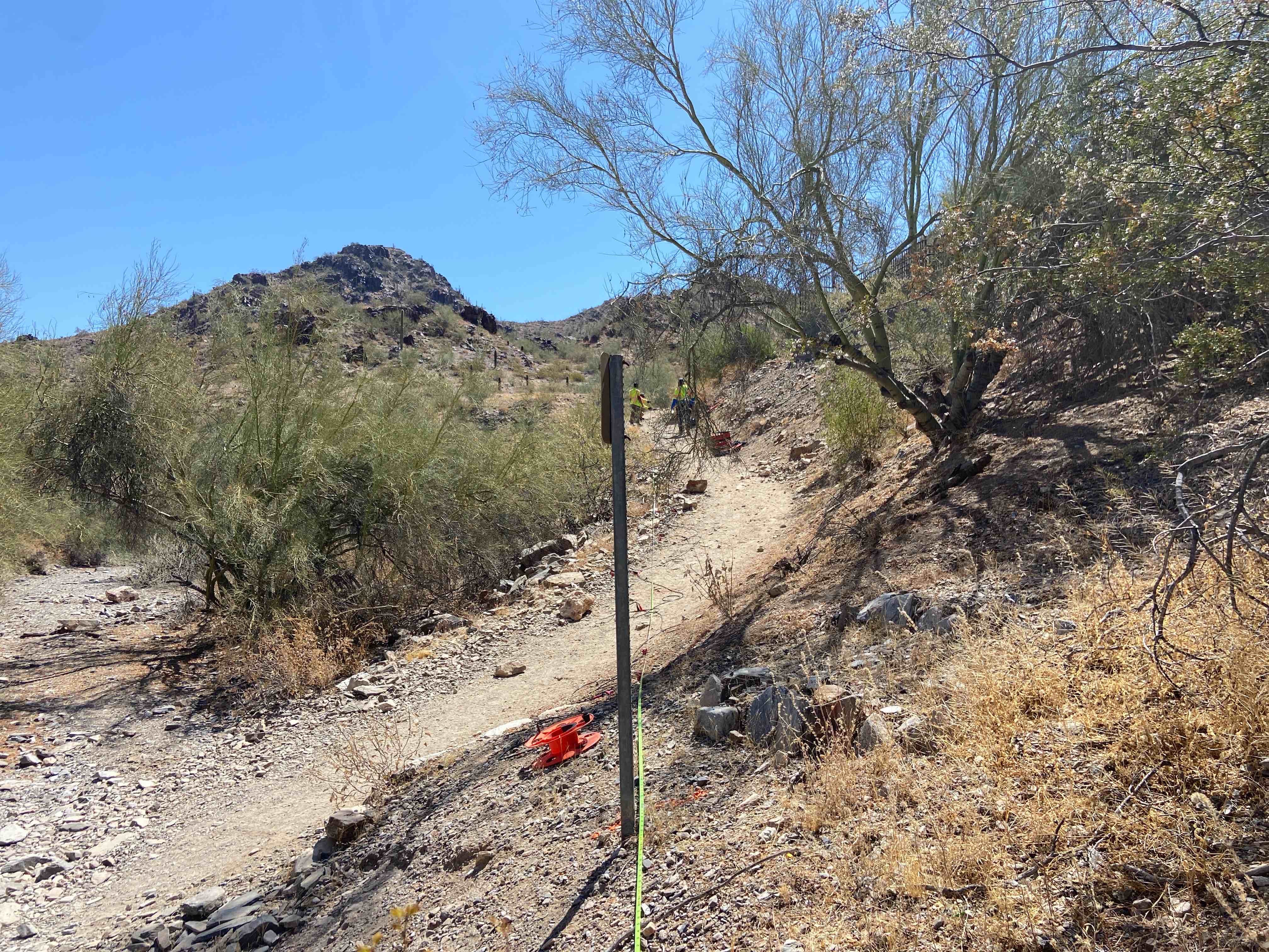
Refraction Microtremor Seismic Investigations, Arizona
Advantage Geophysics, Inc. has completed numerous 1-D and 2-D Refraction Microtremor (ReMi) profiling evaluations to develop shear-wave velocity profiles of the subsurface down to 100 feet below ground surface, generally for planned construction projects including transportation, power plants, data centers, technology centers, microchip fabrication plants, national hospital groups, military bases, dams and water retention structures, open pit mines, and airports. One of the purposes of a 1-D ReMi evaluation is the determination of IBC Vs30 seismic Site Class. Purposes for 2-D ReMi profiling evaluations includes detection of depth to bedrock, detection of potentially liquifiable soils, and obtaining seismic velocity information when faster materials overlie slower materials (where standard seismic refraction methods will not work). Our ReMi evaluations involve passive and active source data collection to ensure that a wide range of frequencies are being collected, and to aid in purposefully biasing the collected data's phase angle down the seismic spread. This type of evaluation is incredibly versatile in that it is insensitive to subsurface velocity inversions or "noise" (ground vibrations) at project sites meaning it can be used even in "very busy" urban locations that include surface pavements.
Seismic Refraction for Pedestrian Bridge, Arizona
Advantage Geophysics, Inc. was contracted to perform a seismic refraction evaluation in a large municipal park in Arizona. The purpose of our evaluation was to develop subsurface velocity profiles of the areas surveyed, and to evaluate the apparent rippability and velocities of the subsurface materials. Our evaluation consisted of three seismic refraction lines. The resulting seismic tomography models revealed distinct relatively low velocity materials in the near-surface and generally relatively higher velocity materials at depth. In the tomography models, the relatively low velocity materials are most likely topsoil, colluvium and/or alluvium with the relatively higher velocity materials likely representing weathered and non-weathered bedrock. Also evident in the tomography models are substantial and distinct lateral variations in velocity which may be related to boulders, intrusions, fracturing, differential weathering, and/or a combination of these features. Our geophysical evaluation results were presented in an illustrated report and will be used to aid the design and construction of the project.
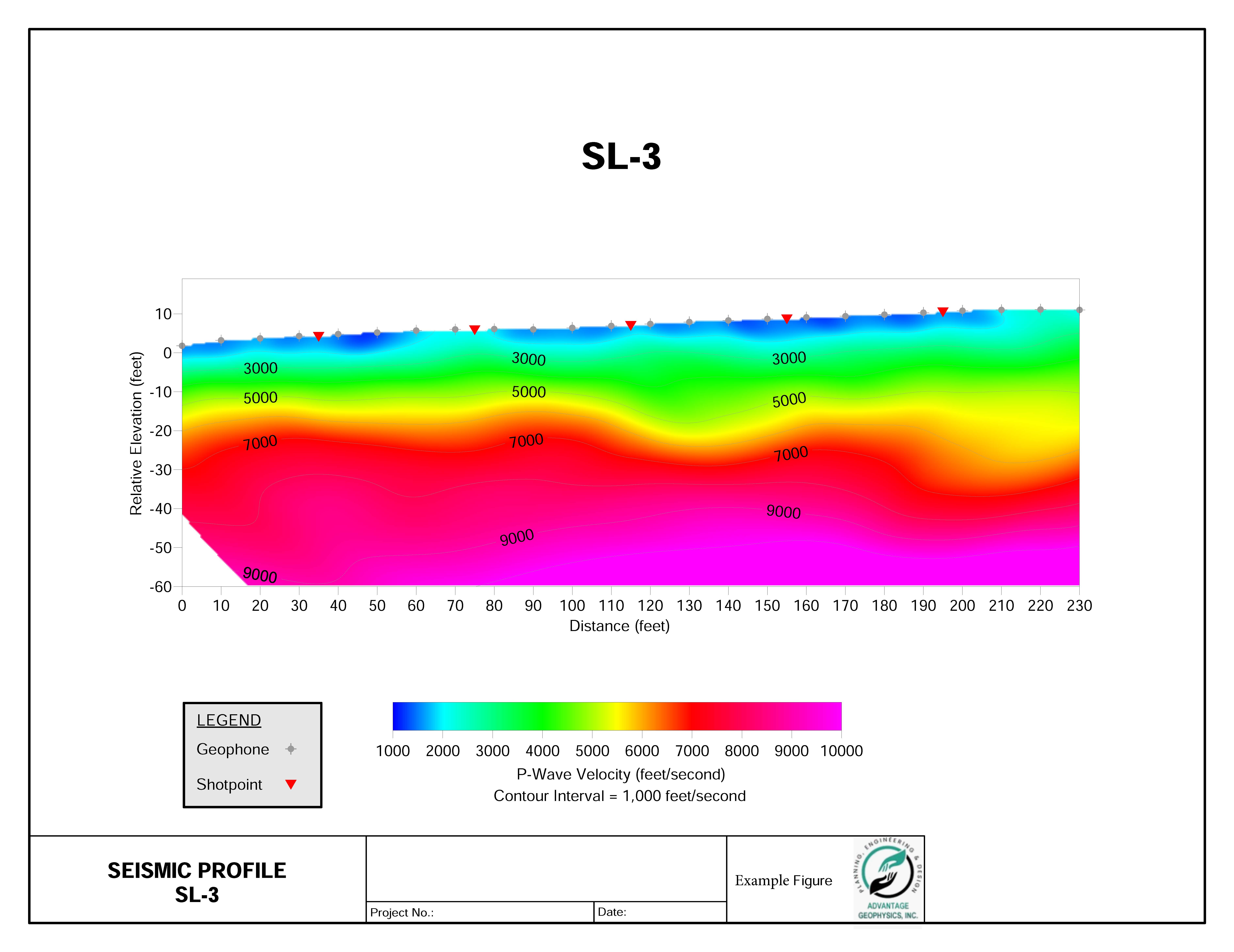
Seismic Refraction for Future Park Construction, Arizona
Advantage Geophysics, Inc. was contracted to perform a seismic refraction evaluation prior to the grading of a planned neighborhood park in Arizona. The purpose of our evaluation was to develop subsurface velocity profiles of the areas surveyed, and to evaluate the apparent rippability and velocities of the subsurface materials. Our evaluation consisted of four seismic refraction lines. The resulting seismic tomography models revealed distinct relatively low velocity materials in the near-surface and generally relatively higher velocity materials at depth. In the tomography models, the relatively low velocity materials are most likely topsoil, colluvium and/or alluvium with the relatively higher velocity materials likely representing weathered and non-weathered bedrock. Also evident in the tomography models are substantial and distinct lateral variations in velocity which may be related to boulders, intrusions, fracturing, differential weathering, and/or a combination of these features. Our geophysical evaluation results were presented in an illustrated report and will be used to aid the design and construction of the project.
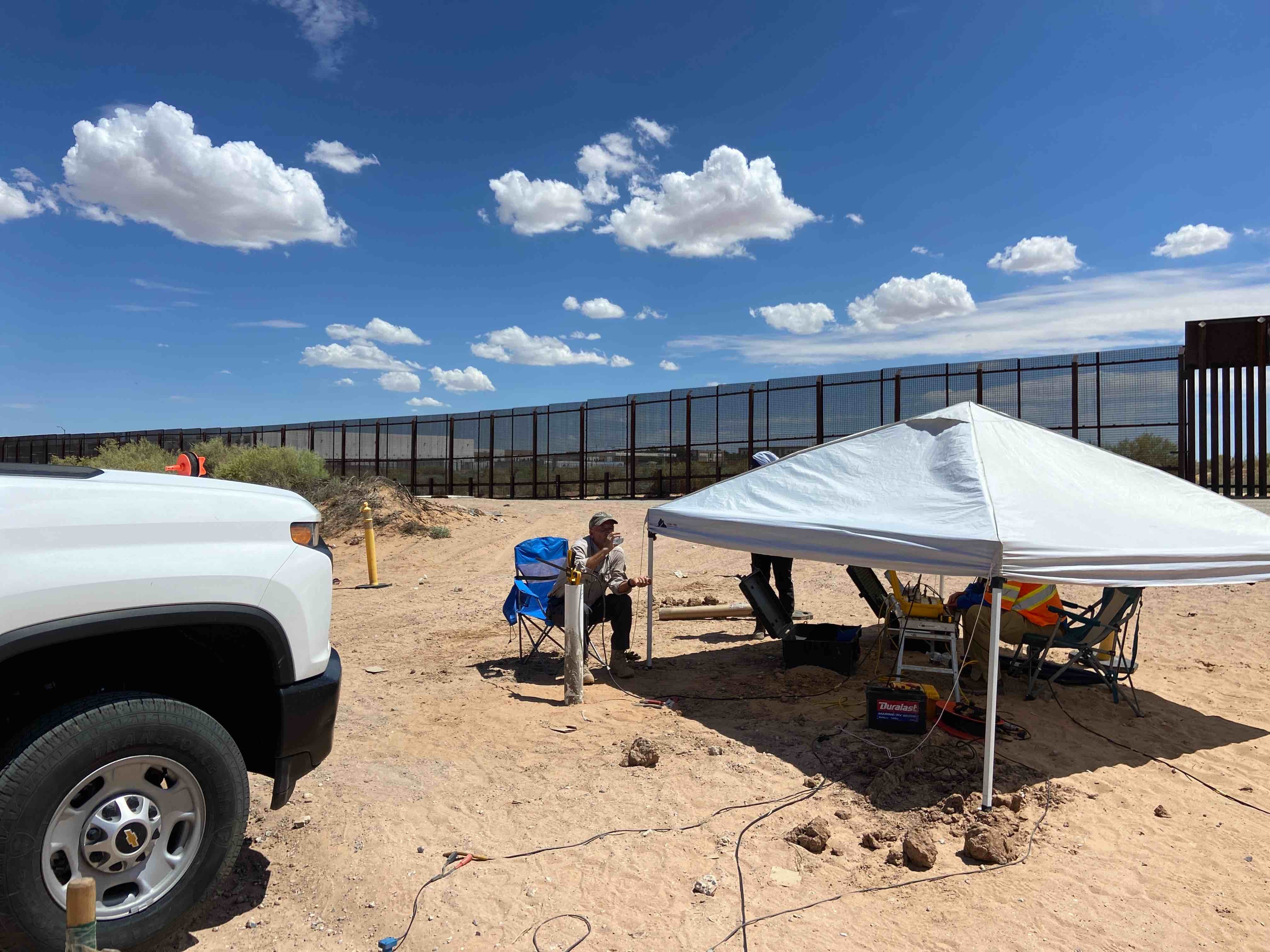
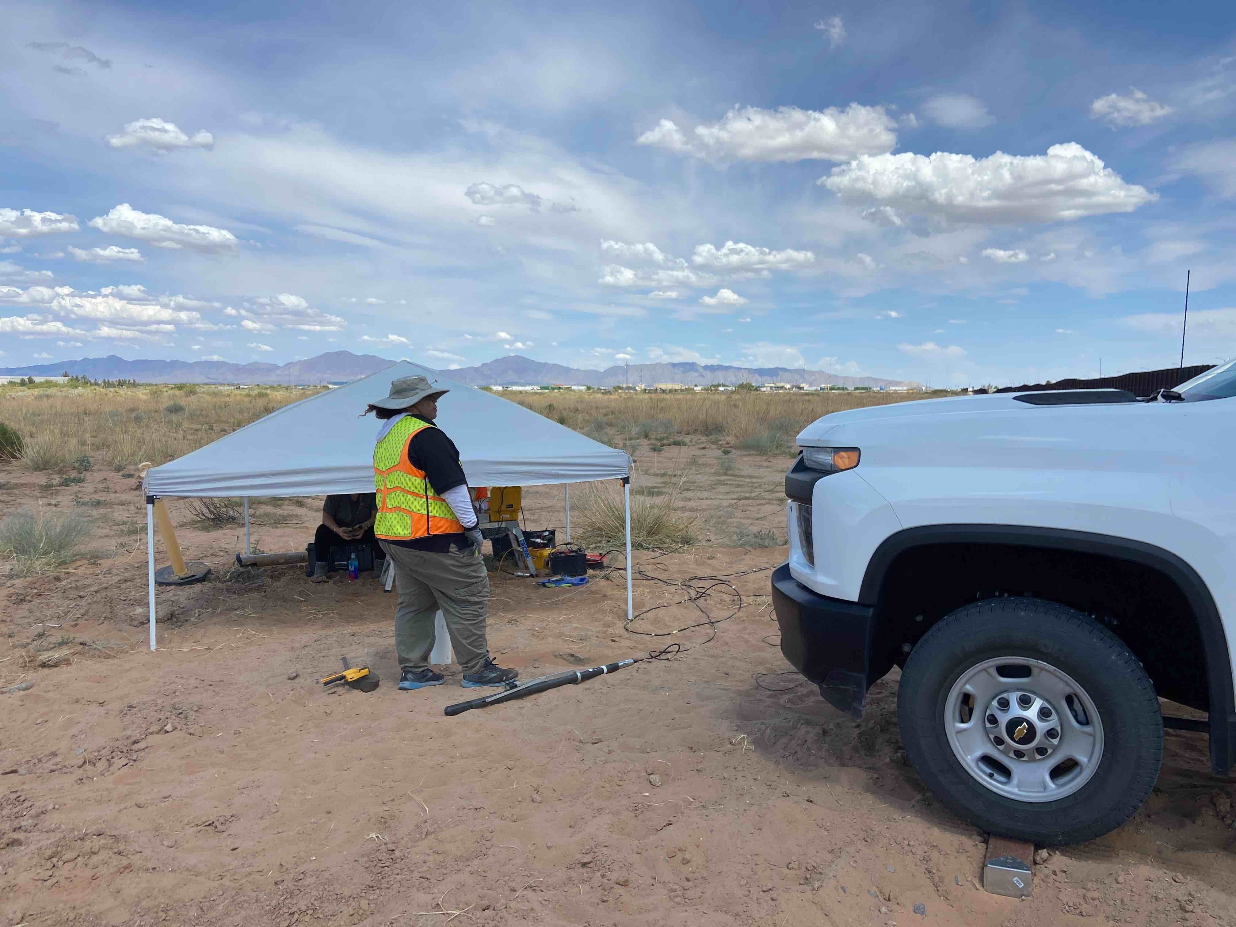
Surface to Downhole Seismic near International Border Wall, New Mexico
Advantage Geophysics, Inc. was contracted to perform a geophysical evaluation involving surface to downhole seismic testing requested by the US Department of Homeland Security (DHS). Surface to downhole seismic testing was performed in general accordance with ASTM D7400 at 5 feet intervals below ground surface to the total depths explored of about 100 feet bgs in three separate PVC cased boreholes to obtain the average P-wave velocity, shear wave velocity, and Poisson's Ratio in each depth interval.